Navigating Arctic Logistics: A Journey of Surveying and Survival

It’s not every day that you see a CEO of a geomatics company trading in their office for the rugged terrain of the Arctic, but that’s exactly what Paul Burbidge, Challenger Geomatics’ CEO and President has done! In this captivating blog, he shares his firsthand experiences working in one of the most remote areas in Canada and on this planet.
From the challenges of navigating Arctic logistics to the awe-inspiring beauty of the landscape, his time in the field provides a rare insight into the realities of land surveying. Keep reading to find out more as he reflects on the lessons learned and the deep connection to nature that comes with this vital work. Dive into his journey and discover why these experiences are so essential to Challenger’s mission!
Written By: Paul Burbidge | President and CEO
Challenger Geomatics has been providing survey support of the administrative transfer of Nunavut crown lands from the Government of Canada to the Government of Nunavut. Certain assets or liabilities are to remain with the federal government after the devolution process is complete. In many cases it is beneficial to have a legal survey performed to define the boundaries of these federal interests.
This post covers only one of the multiple trips that are required for this job.
The High Arctic
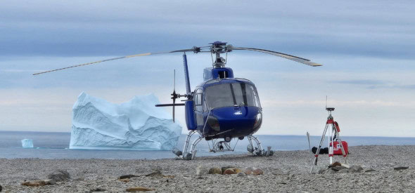
This particular trip started in Yellowknife. The mission was to survey one site about 100 km south of Cambridge Bay and two others on the northeast shore of Baffin Island. Bailey, a new CLS, was scheduled to perform two surveys out of Resolute Bay via Twin Otter at the same time. We had scheduled the work so that if weather prevented her from surveying the south side of these sites, I would be able to do it with the helicopter as a backup.
I flew to Yellowknife ready to go, but a few helicopter outfitting issues delayed our departure by two days. Once we got going, we had a good flight north and were able to complete the first site before landing in Cambridge Bay late in the day. En route, we flew up the west coast of Bathurst Inlet, which I had always wanted to see. At times, we were in heavy smoke, but by the time we made the over-water crossing to Victoria Island, we were out of it.

S.N.A.F.U
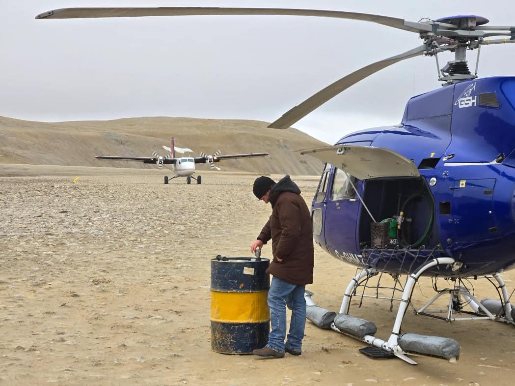
The next day, we had a few long over-water crossings that required good weather. Unfortunately, we didn’t have it. After crossing from Victoria Island to King William Island, we had to backtrack and land due to fog. While we waited for the fog to clear, smoke rolled in from the south, and conditions deteriorated further. We spent three hours on the ground until Conor, the pilot, felt it was worth a shot. He had some trouble starting the helicopter, but he eventually worked it out, and we were on our way to our next stop: Gjoa Haven. After a quick refuel in Gjoa Haven, we hopped over to Taloyoak, where we refueled again. In Taloyoak, the helicopter was even more temperamental, and we had to suspend our program to wait for repair. An engineer was able to fly in the next evening, and we got going again after two unscheduled nights in Taloyoak. The Yellowknife office was quick to jump on my downtime, as they had work in Taloyoak that kept me busy while we waited for the repair.
Heading North
From Taloyoak, we headed north. During our weather stop on King William Island, I learned that our scheduled Twin Otter flights had been cancelled (long, unusual story). As a result, my new plan was to survey the northern Somerset Island site before going to Baffin Island.
One of our fuel stops had us land near Fort Ross, which was the last Hudson’s Bay post ever established. It was only in operation for 11 years before being abandoned. It was abandoned because resupply ships could not reach it some years due to ice. Two buildings remain on site. I like being in the middle of nowhere but spending two or three years there without resupply would be a bit much for me. It seemed forlorn during our brief stop.
As we continued north, we had to land two more times before reaching fuel at Storm Camp. Storm Camp is about 50 km from our site. While refueling, the weather deteriorated further, so we waited it out.
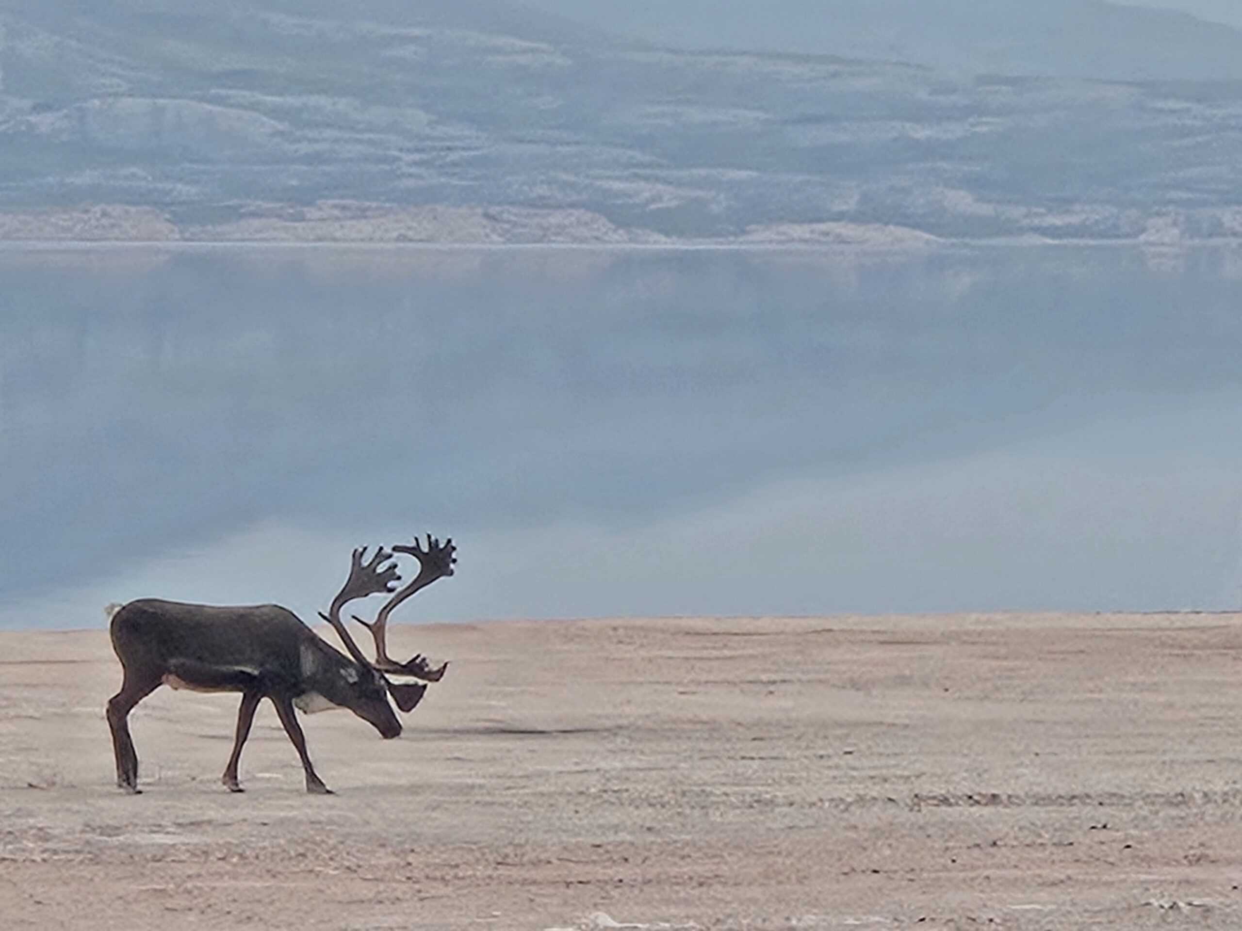
We saw our first polar bears between our stops due to fog. By the end of the trip, we had seen 10 bears. We also saw hundreds of seals, n, and caribou.
Stormed In (No Pun Intended)
We had planned to just grab fuel at Storm Camp, complete our survey, and continue across to Arctic Bay on Baffin Island. After a few hours, we were able to slip out and fly along the coast to our site, 50 km away. The weather deteriorated during the survey, and we had to overnight at Storm after finishing the survey. The weather remained bad the next day, so we stayed put for a second night. Fortunately, the food was great, and the people at Storm were friendly. By the end of the day, though, I was starting to get a bit stir-crazy.

Let’s Go!
The weather broke overnight as predicted, and we were able to cross to Baffin Island and Arctic Bay first thing in the morning, with unlimited visibility!
We stopped briefly in Arctic Bay to pick up our wildlife monitor, Rick, and our cargo. Rick had managed to retrieve our cargo the day before, so we didn’t have to wait for the cargo facility to open. Soon, we were back in the air, heading toward two survey sites on the northeast shore of Baffin Island.
The flight to the sites was spectacular, taking us over glaciers and breathtaking terrain.
Once we hit the ground, we were running. We had a lot of work to do, and I knew it was possible to get everything done if we were efficient and caught a few breaks. I had done all the prep work possible before getting on-site, in case it made the difference between spending one or two (or more) days there.
The reality of this type of work is that wasting good weather can really set you back. I’ve learned this lesson, and we were able to capitalize on the favorable weather and site conditions to survey both locations in one long day. It felt good to make up some of the time we had lost earlier due to other challenges.

Thing’s Don’t Always Go As Planned
On the flight back to Arctic Bay, we flew along the coast instead of taking the direct route to the site, as we had on the inbound flight. The coastal scenery was just as spectacular as the direct route.
Due to our delays in reaching Arctic Bay, our hotel reservations were lost, and the hotel was fully booked. These projects don’t succeed without a solid team on the other end of texts and InReach messages. Cathy, Colin, Great Slave Helicopters, Dylan, and Bailey all provided me with the data and information I needed to keep moving forward. In this case, Cathy managed to find us a cabin in Victor Bay, where we could stay for the night before starting the long journey back to Yellowknife.
The trip back to Yellowknife featured good weather, fishing, Bears, Caribou, Musk Ox, airport sandwiches and a bit of smoke.
Thanks to everyone who made this trip work out. Especially Rick, Conor and our Sub-Arctic Yellowknife Team.
If you’re interested in learning about other projects we’ve done across Canada’s arctic click here.